A STORM WITH HURRICANE WINDS AFFECTED IZAÑA OBSERVATORY ON EARLY MARCH.
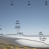
On March 3 and 4, 2013 a deep Atlantic storm moved from west to east and hit the Canary Islands, causing a storm of wind and rain widespread throughout the archipelago, especially in the western islands. The highlands around the Izaña Atmospheric Observatory (Tenerife, 2,364 m a.s.l.), and the El Teide national Park, were affected by an episode of winds accompanied by weak to moderate rainfall.
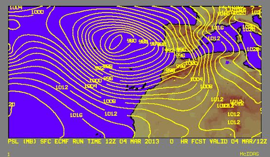
IMAGE 1
Map of atmospheric pressure at sea level on the 4th March at 12Z. It can be seen that the isobars are very tight, indicating that there is a large pressure difference between points very close together, which is associated with very high winds.
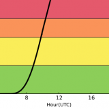
We talk about hurricane winds when the wind speed exceeds 120 km / h. In this episode strongest gusts far exceeded that value: on March 3 we recorded 157 Km / h, and on March 4 we reached 174 Km / h. But besides the gusts is interesting to note the recorded high values of average velocity (10-minutes averages): the highest average speed was 127 km / h on March 3, 137 Km / h on March 4. This means that for 10 minutes speed winds were equivalent to those produced in a Category I hurricane according to the Saffir-Simpson scale. This situation lasted for an hour on March 3, and about an hour and a half on March 4, but not consecutively. On March 5 the wind speed diminished and no longer gusts reached hurricane category, although they were quite strong, with a maximum value of 118 Km / h. The prevailing wind direction was originally from west-southwest, to roll west-northwest later.
The rainfall, as mentioned, was weak/moderate, collecting during the episode a total of 49 total l/m2, which during some hours were in the form of snow, although without jell, because wind dragging and because the temperatures were not especially low during the episode: the minimum temperature recorded was -0.8 ° C and during most of the episode was above 0 ° C, except for afternoon March 4, when it was slightly below. Early in the evening of March 3 there was thunderstorm activity in the vicinity of the island of Tenerife and lightning struck near the Observatory that affected slightly some equipments and instruments.
Another significant record was the very low atmospheric pressure recorded during the storm, with a value of 741.8 hPa at 4:40 pm on March 4. This record is the sixth lowest in the nearly 100 years of uninterrupted observations and is just a few tenths above the pressure measured during the passage of “Delta” tropical storm in November 2005.
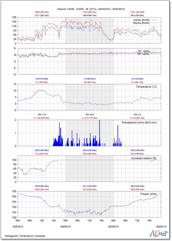
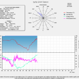
IMAGE 2
Atmospheric parameters measured Izaña Atmospheric Observatory during March 3-5-, 2013. A significant drop in wind speed was observed in the second half of March 4, then increased in the early hours of March 5. Although there was actually a decrease in wind speed, it appears amplified in the record by the fact that the anemometer cups moved more slowly due to ice on its surface.
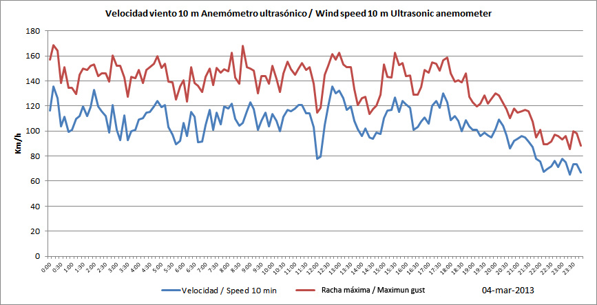
IMAGE 3
Graphic of wind speed on March 4 with data obtained with an ultrasonic anemometer, which is not affected by the accumulation of ice having no moving parts. The ultrasonic anemometer also recorded the decrease in wind speed, but less marked (see values of wind speed in the vertical axis of the graph compared with above). Early March 5 the temperature rose above 0 ° C and then both instruments recorded the same values.
As usual, during some hours before the storm, the typical lenticular cloud appeared on the Pico del Teide. This is the famous “hat” whose presence Tenerife farmers have traditionally associated with the upcoming arrival of rains, as happened on this occasion. The presence of such a cloud over the Teide indicates presence of wind and humidity to levels where it is visible, which may be an indication of the arrival of atmospheric instability:
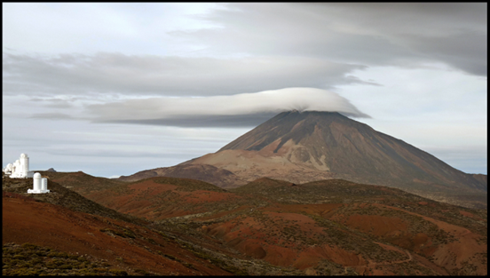
IMAGE 4
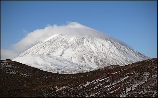
IMAGE 5
The first image shows the Pico del Teide with lenticular clouds on the morning of March 3, in a snapshot taken from Izaña Observatory. The second image, taken from the viewpoint located in the beginning of the road to the Izaña Observatory on March 5 shows a positive result of the storm, as the snow is covering the volcano almost from its base.
Through the Observatory webcam we could monitor the arrival of the storm. Animation of images taken every five minutes by the camera facing the valley of La Orotava:
VIDEO 1
{flv width=”500″ height=”350″ flashver=”0.0.0″ alt=”Error”}Time_lapse_3310_orot2{/flv}
The Izaña Observatory did not suffered major damage due to wind, but in this video we can see its intensity:
VIDEO 2:
{flv width=”500″ height=”350″ flashver=”0.0.0″ alt=”Error”}Viento_huracanado_reduc{/flv}