A storm with gale-force winds and heavy rain affects Izaña Atmospheric Observatory in last few days
From November 28 to 30, the Canary Islands were hit by a storm bringing strong winds which reached gale force (average speeds of over 120 Km/h) in some areas, like at the Izaña Atmospheric Observatory (IZO). There was also significant rainfall and, while the storm did not generally bring about a marked drop in temperatures, the first snows of winter fell on Teide.
Figure 1: View of Teide’s peak from Izaña Atmospheric Observatory at dawn on December 1 after the storm. Photograph courtesy of Antonio Hernández, security guard at Izaña Atmospheric Observatory.
The synoptic situation over the Canaries those days was dominated by the presence of a deep low at all levels which crossed the archipelago from west to east and which was being absorbed by another long-wave low front. Together, they caused intensive SW flow over the archipelago, with dynamic forcing and thermal instability, over which was a jet stream at low levels.
Figure 2: Top, pressure map at sea level and temperature 850 hPa. Bottom, geopotential map and temperature 500hPa, both on November 29 at 00 UTC. The low front can be seen to the west of the Canaries at both levels and intense SW flow may be deduced from the distribution of the isobars.
Figure 3: Oblique diagram of the Güimar sonde (station 60018) on November 29 at 00 UTC. Indications of strong moisture advection at practically all levels and the presence of a jet-stream at low levels, with very strong, even gale-force (over 60 knots; 65 knots at 700hPa level, to be accurate) SW winds.
Given the situation, the Agencia Estatal de Meteorología (Meteorological State Agency of Spain) declared a red alert (extremely high risk) for wind on November 29 for all the western islands. The hardest hit areas on Tenerife were the mountain peaks and certain parts of the northern area, in particular the municipalities of Los Realejos and Puerto de la Cruz, among others.
At the Izaña Atmospheric Observatory, gusts of wind of up to 191.2 Km/h were registered in the early hours of the 29th and the total rainfall collected was 128.4 mm. The storm was accompanied by lightning, which was particularly intensive in the early hours of November 30.
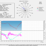
Figure 4: Graphs of values corresponding to different meteorological variables registered by the SOSS station set up at the Izaña Atmospheric Observatory during the episode.
Figure 5: Left: infrared MSG-2 images with lightning detected over the Canary Islands on the 30th in the fifteen minutes before 2.15 UTC. All the bolts of lightning (crosses and red dots) were, therefore, detected in the short time of only fifteen minutes. Right: map of all bolts of lightning detected during the whole episode. The electrical storm was very intense, especially to the south of the archipelago, although there is a marked band of electrical activity over the Teide national park affecting Izaña. Total amount of detected lightning was over 18.000.
The area around the Izaña Atmospheric Observatory was hit hard by winds, although there was no major damage. A few roof panels were torn off, a couple of communications parabolic aerials disappeared, though some pieces were found 500 m away. Some pieces of equipment, like the Brewer spectrophotometers and the Cimel photometers on the tower roof, had, fortunately, been removed on Sunday 28th as a precaution. To give us an idea of the force of the winds, the following will serve as graphic examples: a large branch of Teide Gorse (Spartocytisus supranubius), an endemic species at altitude in the archipelago, was uprooted and dragged various scores of meters and almost crashed into the Izaña Atmospheric Observatory meteorological station hut. The already damaged solar panel installation was further damaged.
Figure 6: Branch of Teide gorse dragged by the wind and which hit one of the columns supporting the meteorological station hut. Solar panels destroyed by the storm.
In spite of this, the storm also had its pleasant side, as it brought the first snow of the year to Teide, which showed off its impressive snowy mantle when the skies cleared


