IGN’s volcano monitoring system: gravimetric measurements at The Izaña Atmospheric Observatory
![]()
One of the roles assigned to the National Geographic Institute (Instituto Geográfico Nacional – IGN) is planning and management of volcano surveillance system, transmission of the volcano information to the Civil Protection authorities in the country and determining the associated risks (established by : Real Decreto 1476/2004 of 18 June).
The IGN’s monitoring systems include permanent geophysical and geodetic stations, temporal stations and field campaigns:
Continuous:
– Seismic stations (short and long period)
– GPS
– Gravimeters
– Magnetometers
– Tide gaugesCampaigns for:
– Deformation monitoring
– Gravimetry
– Geochemistry
– Self potential
Gravimetric techniques used in volcano monitoring are based on the observation of temporal variations of gravity values, caused by variations in mass and/or density in the subsurface.
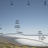
The Izaña Atmospheric Observatory is included among the sites chosen for gravimetric measurements as a key station of the gravimetric network. Its conditions, due to its location, away from any kind of anthropogenic noise, and its facilities, easy maintenance and control of the instrumentation, made it suitable for this type of measurements.
Since November 2009 a continuously recording gravimeter gPhone MicrogLacoste was installed at the Izaña Atmospheric Observatory (Figures 1 and 2). The aims of this installation could be summarized as following:
1 .- Obtain an accurate model of terrestrial tide in Tenerife.
2 .- Study the possible changes of mass or/and density in the subsurface.
3 .- Serve as a complement to the rest of the data collected from the IGN´s volcano monitoring system
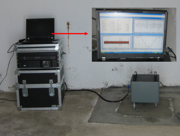
Figure 1: Continuous recording gravimeter located at the Izaña Atmospheric Observatory.
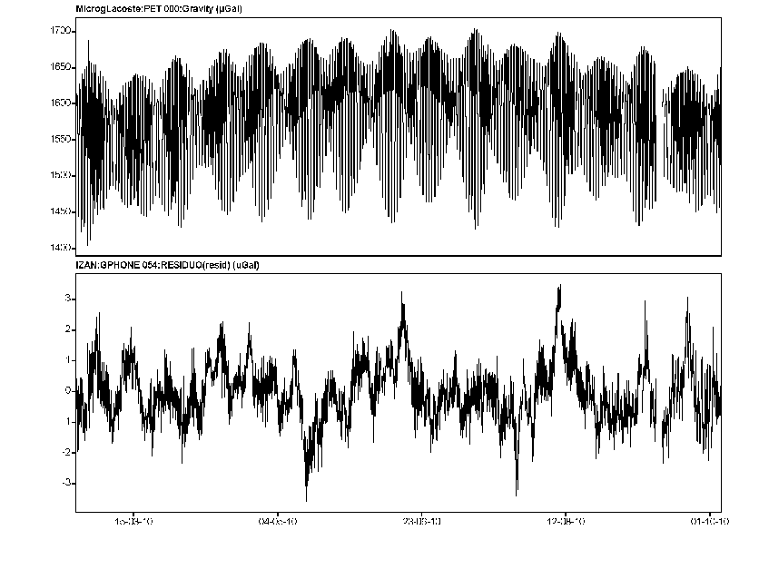
Figure 2: Evolution of the terrestrial tide and residual gravity for the last 6 months.
From 23 of September to 4 of October 2010, an intensive field surveillance had been performed for re-observation of the gravity network established in Tenerife since 2004 by the National Research Scientific Council (CSIC) and nowadays observed by IGN in the collaborative framework established between both institutions for the volcano data analysis.
This network includes 15 stations, with one of the benchmarks located at the Izaña Atmospheric Observatory.
So far, five such campaigns were accomplished (October 2008, May and October 2009, May and October 2010) without registering any significant variation in the value of gravity.
The GPS of the IGN is used by the Izaña Atmospheric Research Center for determining hi-accuracy column water vapor from ZTD data calculated by the IGN.
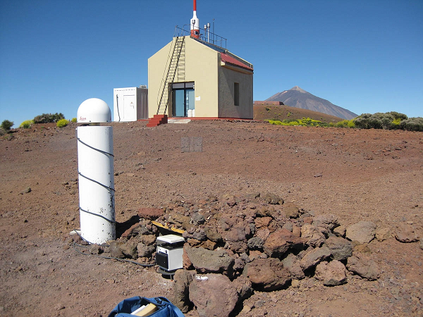
Figure 3: GPS and gravity observation at Izaña Atmospheric Observatory