THE IZAÑA OBSERVATORY, BATTERED BY A STRONG WINTER STORM (15th-18th FEBRUARY, 2014)
The Izaña Atmospheric Observatory was hit by a severe winter storm that, besides causing a remarkable decrease in temperatures, brought snow, winds with hurricane gusts, thunderstorms and a significant accumulation of ice and rime since early February 15th until the morning of the 18th.
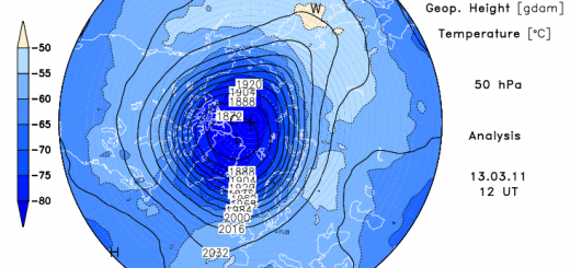
For several weeks, the movement of Atlantic storms stood at slightly above the Canary latitude, affecting the Iberian Peninsula with the already popular “cyclogenesis ” that occurred repeatedly over the North Atlantic. The Canary Islands remained under a bonancible anticyclonic situation, with trade winds of weak intensity. This situation suddenly changed on 14th February, when a rapid cyclogenesis over the Azores Islands occurred, which also was preceded by a strong advection of cold polar air on the American East Coast. All this resulted in a wave movement in height, elongated southward, as long trough, with a cold front active and powerful cold post -frontal discharge fed by an air of polar origin, produced a strong destabilization of the atmosphere over the warm ocean and a sudden and sharp decline in temperatures over the Archipelago.
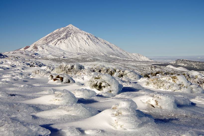
Most of the Canary Islands were affected by this situation. The snow level, due to the low temperatures, was situated just above the 1,300 meters approximately, although in some areas it snowed below that level.
The change of weather caused by the arrival of the cold air mass was very abrupt: late in the day on February 14 thermal decline of almost 4°C in about half an hour occurred, the relative humidity increased from 25% to 100%, and the sky, which was previously clear, was completely covered by clouds that reached the observatory. Rainfall began almost immediately, and was at first in the form of rain, but the temperature continued to drop and soon the rain became snow.
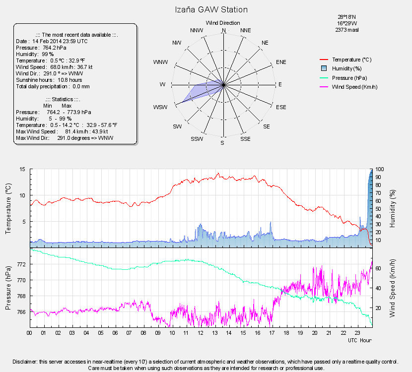
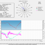
Graphic of the atmospheric parameters recorded at the Izaña observatory last February 14th. The sudden drop in temperature at late hours, and the increase in relative humidity, the increase in wind strength (which occurred from the afternoon) and the decrease in barometric pressure from about noon were observed.
The drop in temperature lasted until dawn on the 15th, reaching a temperature of -4 ° C at about 5:10 pm. On February 15, the maximum temperature occurred at 1 am., i.e., when the storm was just starting. The maximum temperature on the 14th was 14.2 ° C, i.e. 12.6 º C higher, so we speak of a remarkable decrease in maximum temperatures, since the difference between the values of both days was over 12 º C. But more remarkable even is the temperature difference early in the afternoon: at 15:40 on the 14th, 13.6 ° C were recorded, while at the same time of day 15 the temperature was -4.3 ° C. The temperature difference at 24 hours was, therefore, of almost 18 ° C.
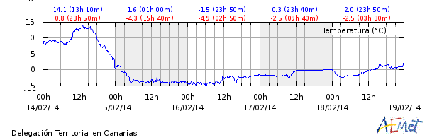
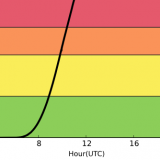
Graph of the temperature at Izaña, from 00h (February 14th) to 00h (February 19th). The values remained below freezing for 84 hours, although the accumulation of rime in the weather shelter could distort the data on February 17th, which remain suspiciously stable for more than twelve hours.
Special mention deserves the wind, which was blowing with unusual force, recording hurricane gusts (over 120 Km / h) not initially forecasted by meteorological models. During the morning of the 15th a peak gust of over 142 Km / h was recorded. The accumulation of rime significantly affected the proper wind observations from the 15th, but very strong gusts continued throughout the 15th and the next day.
Precipitation, as mentioned, soon took solid form, aided by low temperatures began to jell on the floor, accumulating a thickness of about 10 cm early in the afternoon of the 15th, surpassing 40 cm thickness 24h later. Some strong wind sheltered areas accumulated more than 80 cm of snow. These snowfalls were generally moderate, with some specific increases in intensity. During the afternoon of the 15th they were accompanied by electrical discharges, some of which fell on surroundings of the observatory, affecting communications and receiving data from meteorological stations.
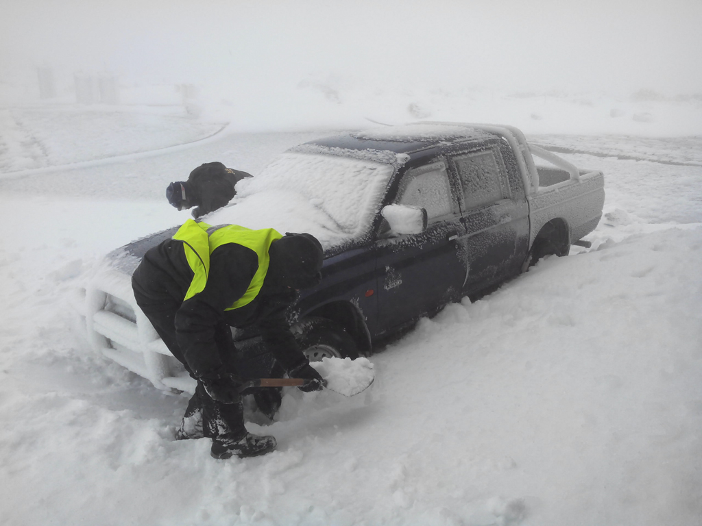
Izaña Observatory staff strives to remove the snow that has buried the wheels of an off road vehicle.
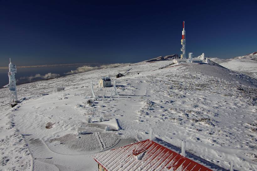
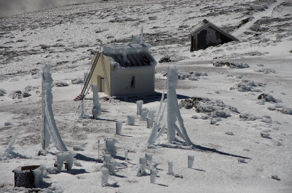
General view of the snow during some clear skies on the 17th. It can be seen in the left and in the center of the image the access road to the observatory and TV relay station is buried by snow.
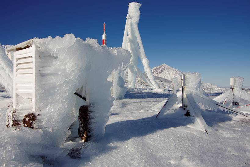
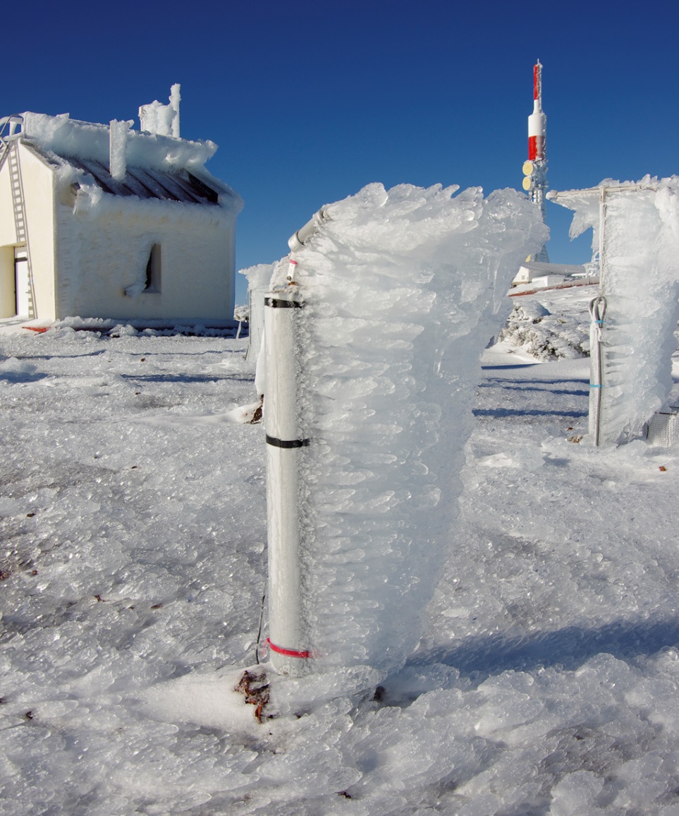
Though it was a snowfall of some importance, certainly the most striking phenomenon of this episode was the rime, which caused a severe damage to our infrastructures. Rime consists on the accumulation of ice on surfaces exposed to the wind. For accumulating rime three factors are needed: strong or very strong wind, temperature below 0 ° C and the presence of fog or low clouds. Under these conditions fog droplets are in a state of under cooling, that is to say, they are liquid even though the temperature is below 0 ° C. These droplets are driven by the wind, and on impact with a solid surface (such as a mast or a tower) are frozen immediately, remaining adhered to that surface. If wind conditions, low temperatures and the presence of fog are maintained, rime may form ice deposits of considerable thickness in the direction from which the wind blows.
In this storm, conditions were favorable for rime for many hours, which resulted in images of great beauty of large deposits of ice, but also caused some damage to some instruments given the enormous additional weight forced to hold.
In the foreground, weather shelter with rime. The accumulation of ice could cause the combined effect of thermal insulation and heat absorption change of state (solid to liquid) that kept the temperature very stable during the second half of the 17th.
Accumulation of ice on a solar radiation sensor and its mast.
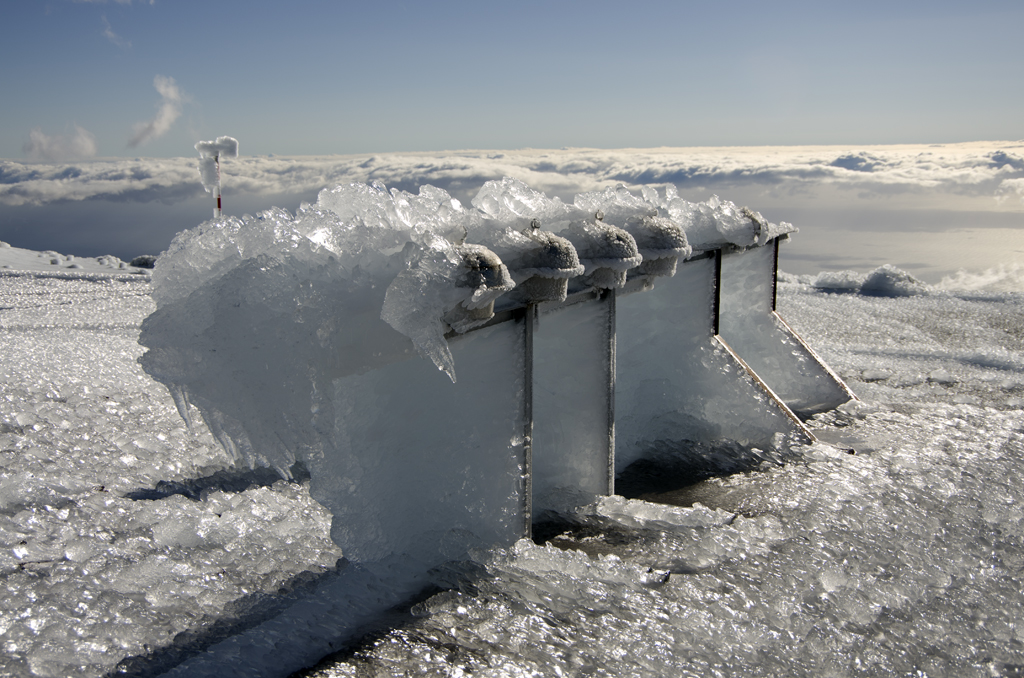
Rime on particle passive samplers and corresponding holders.
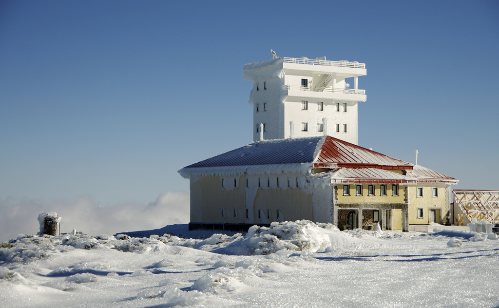
Overview of the accumulation of ice on the instrumental located in the Izaña meteorological garden.
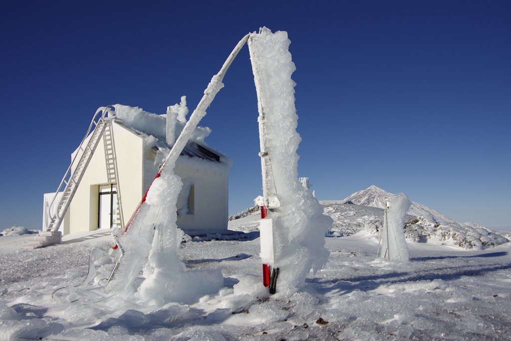
The accumulation of ice caused a broken mast 10 meters high, on top of which the wind sensor weather station is located.
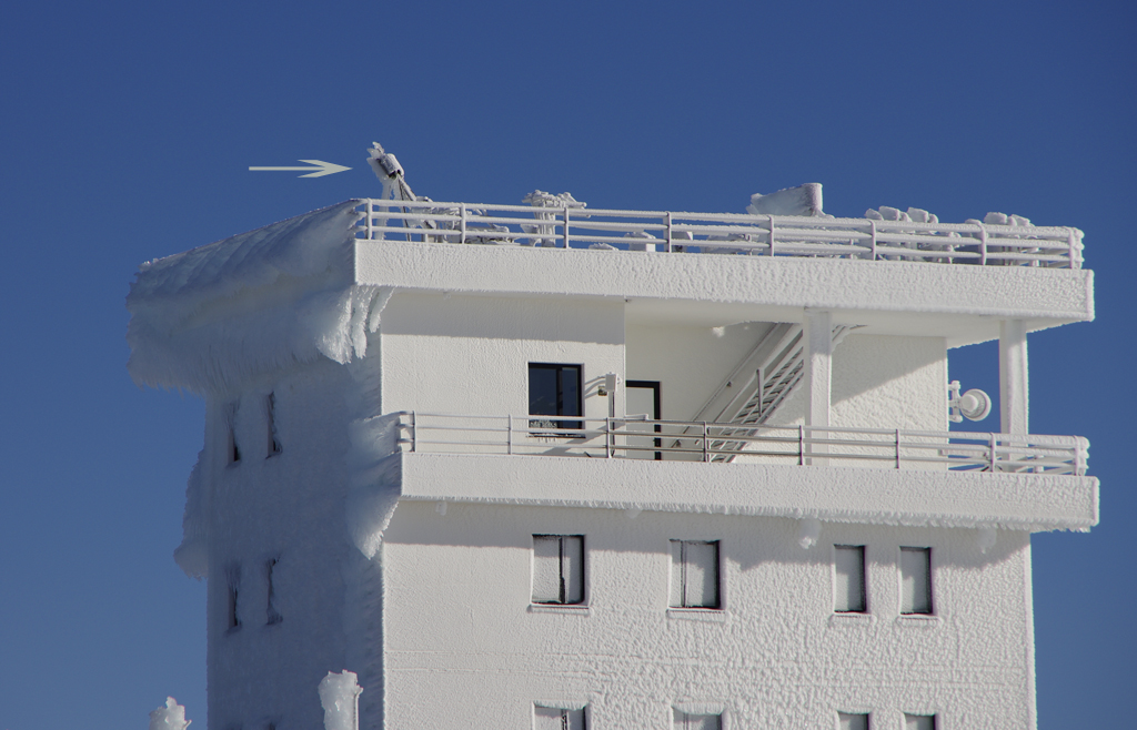
The arrow points to one of the ambient air samplers for measurements of atmospheric gases, which was severely damaged by the accumulation of ice.
According to the most senior staff of the Centre, this episode of strong rime could be one of the most intense of the last 18 years, and despite the damages, allowed to enjoy images of great beauty:
You can see more pictures of the storm of snow and rime by clicking here.