A SNOW STORM AFFECTED THE IZAÑA OBSERVATORY
During the 9th and 10th January 2014, the Izaña Atmospheric Observatory was affected by an episode of severe weather that caused a significant drop in temperatures, electric storms, snow and ice.
This episode, preceded on 8th January by wind gusts from the South of around 90 Km/h at Izaña, was caused by the formation of a deep low with very cold air aloft (-22 º C at 500 hPa, about 5500 m altitude-), and caused a very unstable situation with development of numerous electrical storms and snow, and hail in many other areas of the island of Tenerife.
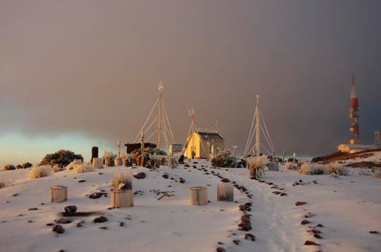
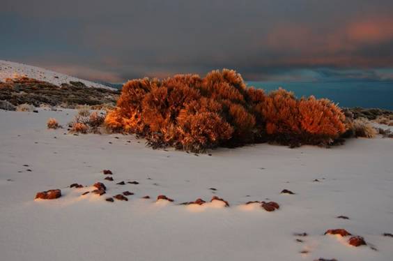
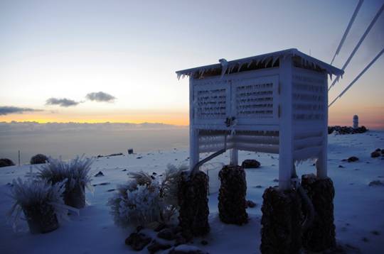
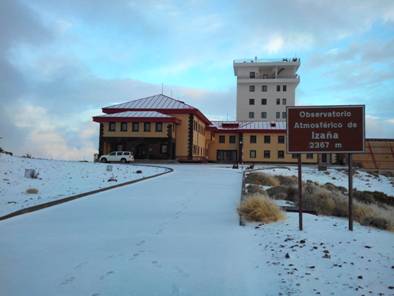
Slight snowfalls occurred throughout the morning and afternoon of 9th January, ceasing in the afternoon. Only a total of 5- 10 cm of snow was accumulated on the soil, but due to the low temperatures the white mantle was frozen, making the outside the observatory an authentic ice rink.
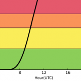
With the arrival of the episode, temperatures dropped sharply and remained very low throughout 9th January. It should be noted, as significant data, the minimum temperature of 8th January (2.1 ° C) occurred at 23:59 h, and the maximum temperature of the day took place at midnight (i.e., a minute later) with the same value. The temperature difference between 8th January at 13:00h and 9th January at 13:00h is also remarkable: within 24 hours the temperature record went from 10 º C to -1 º C, so there was a difference of 11 º C.
Following the rapid passage of the cold low, the wind shifted to the northwest and temperatures remained very low, giving a minimum temperature of -2.8 ° C the morning of 10th January. These subzero temperatures favored the preservation of the ice on the ground and the formation of hard rime on vegetation and instruments of the observatory. As a sample, the following images: