The last quarter December-January-February is the driest in the historic precipitation series of Izaña

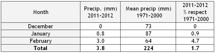
The quarter formed by months of December 2011 and January and February 2012, has become the driest of the winter quarters since the beginning of the time series of the Izaña Observatory in 1916. The 3.8 mm collected from December 1, 2011, until February 29, 2012 are below the previous minimum record, which took place in the quarter formed by the months of December 1965 and January and February 1966, with 8.1mm.
It is interesting to note that the climatological average rainfall for the quarter December-January-February in Izaña Observatory is 206 mm, a value that increases to 224 mm in the period 1971-2000, which means that it has been collected less than 2% of normal rainfall for this quarter.
The following table breaks down the values of precipitation collected:
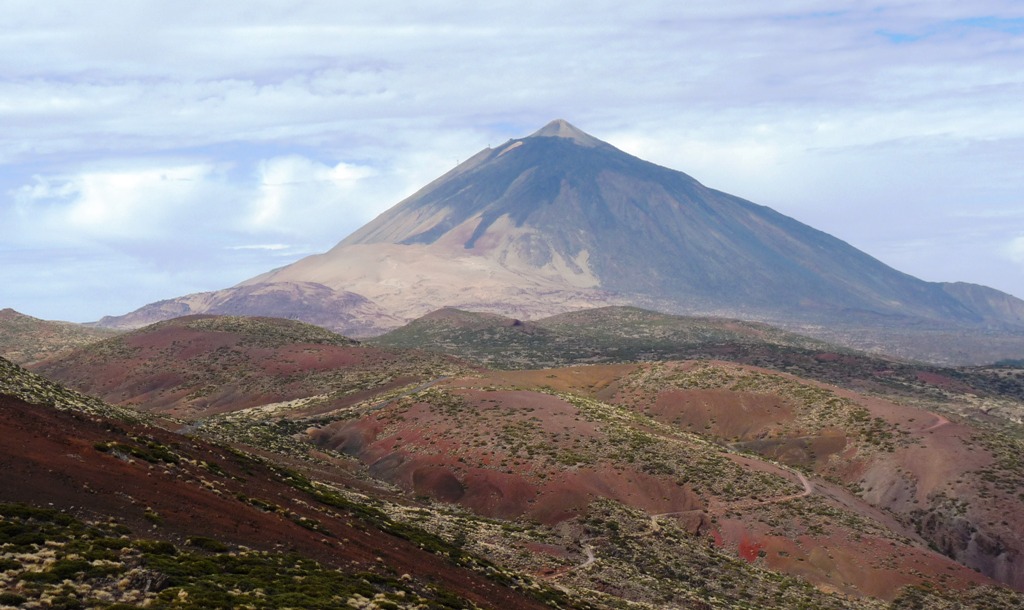
Note also that being very near to the end of the present winter season, only a weak with snowfall has been recorded in the vicinity of the Observatory, located 2,364 meters above sea level. Normally 13 days of snow per year are recorded. Thus, at present the Teide peak does not show its typical wintertime snow cover, as shown in this photograph taken on March 10 from the roof of observation tower of the Izaña Atmospheric Observatory. Despite the presence of medium and high cloud, no precipitation was registered.
An interesting data is the value of precipitation due to fog, also called “horizontal precipitation”. (Click here for more information on how it is measured). In the same quarter, December 2011 to February 2012.75 mm were collected, what represents almost 20 times the conventional precipitation. It gives an idea of the great importance of this type of precipitation even in periods of drought.
But, what is the cause of this severe drought? In part, the answer is given by the NAO (North Atlantic Oscillation) that accounts for the strength and position of the Azores anticyclone. This winter we have “enjoyed” a very positive NAO (a NAO +2.52 +1.17 in December and January), resulting in the Canaries in a dry period with a higher frequency of air masses coming fromAfrica and a lower presence of low and Atlantic fronts. The Dickson’s conceptual model (www.ices.dk/globec/data/bf4/naomap.htm) illustrates this situation very well. The Azores anticyclone in winter, very reinforced in positive NAO phase blocks the passage of low middle-latitude and subtropical lows and fronts increasing, however, the westerly flow above 50 ° N. This low and fronts blockage causes a situation of drought in our archipelago in winter.
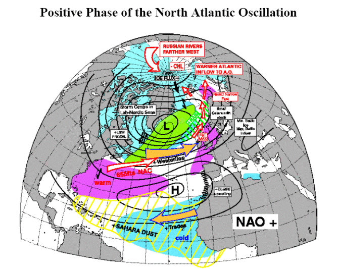
The figure is courtesy of Dr. R. Dickson (www.ices.dk/globec/data/bf4/naomap.htm).
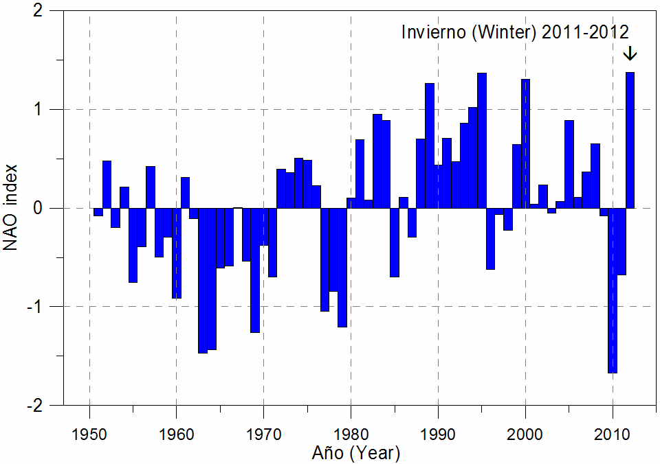
This winter, although there has not been intense dust intrusions, except in recent days, they have been very frequent, which has resulted in an atmosphere with higher presence of suspended particles in Izaña than usual at this season. The graph below shows the historical record of the NAO index in winter (averaging the months of December-2011, January-2012 and February-2012). You can see that the NAO has been very positive this winter (+1.37 on average). Data have been obtained from the NOAA Climate Prediction Center / National Weather Service (available at: www.cpc.ncep.noaa.gov/products/Precip/CWlink/PNA/nao_index.html).
Reported by Rubén del Campo Hernández (rcampoh![]() aemet.es) and Emilio Cuevas-Agulló (ecuevasa
aemet.es) and Emilio Cuevas-Agulló (ecuevasa![]() aemet.es)
aemet.es)